Back when I was in my first winter at MIT and in Boston, I decided to draw up a map of my mental image of the geography of Cambridge and some of the nearer bits of Somerville. Recently, I found it while cleaning my room and thought it worth posting:
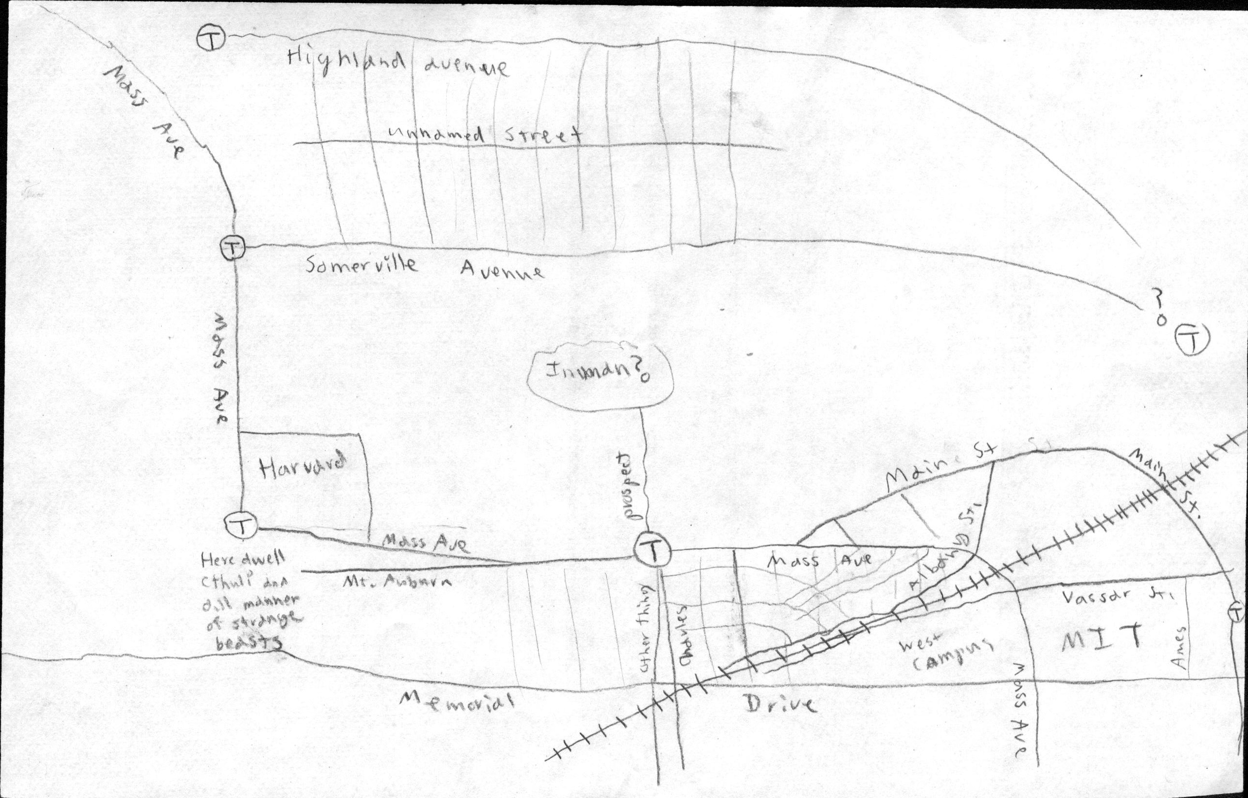
While I was a bit confused on some street names, it’s not as unreasonable as one might expect, or as confused as I gather some of my friends who’ve been here longer are. That said, it seems that back then I still tried to think of Camberville as a grid rather than as a network of connected squares.
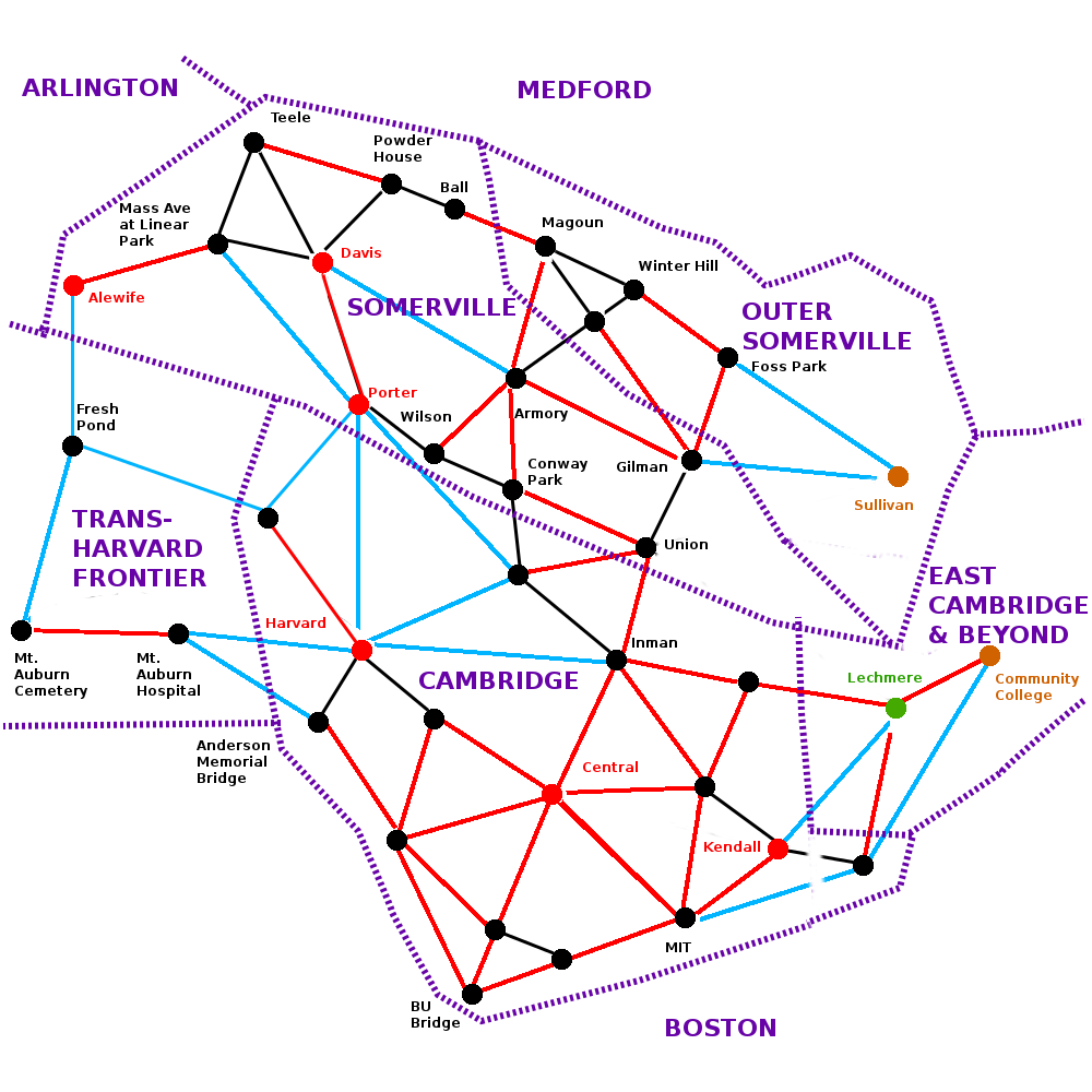
After finding the map, I thought I ought to put together a more modern picture of my understanding of Camberville. This one is drawn as a network with approximate walking times. Black means 5 minutes, red means 10 minutes, and blue means 15 minutes. It is interesting to note that both Cambridge and Somerville seem to form east-west continuums with a rather hard-to-cross gap between them. This actually makes sense if you consider that they to some degree grew up as commuter suburbs of Boston, and downtown Boston is essentially due east of them, so commuter rail and streetcars tended to run essentially east-west to bring people into the city.