
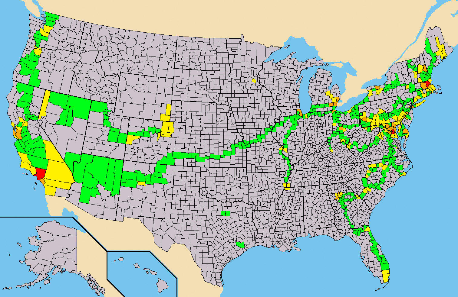
At some point when I was an undergraduate at Caltech, I decided that it was important that I maintain a map of all the counties and county-equivalents (i.e. the District of Columbia, Louisianan parishes, Alaskan boroughs and census areas, and independent cities in the four states that have them) in the United States that I’ve been to. Producing the initial map was a good deal of effort, since it involved tracking down the routes of trips I took as a small child.
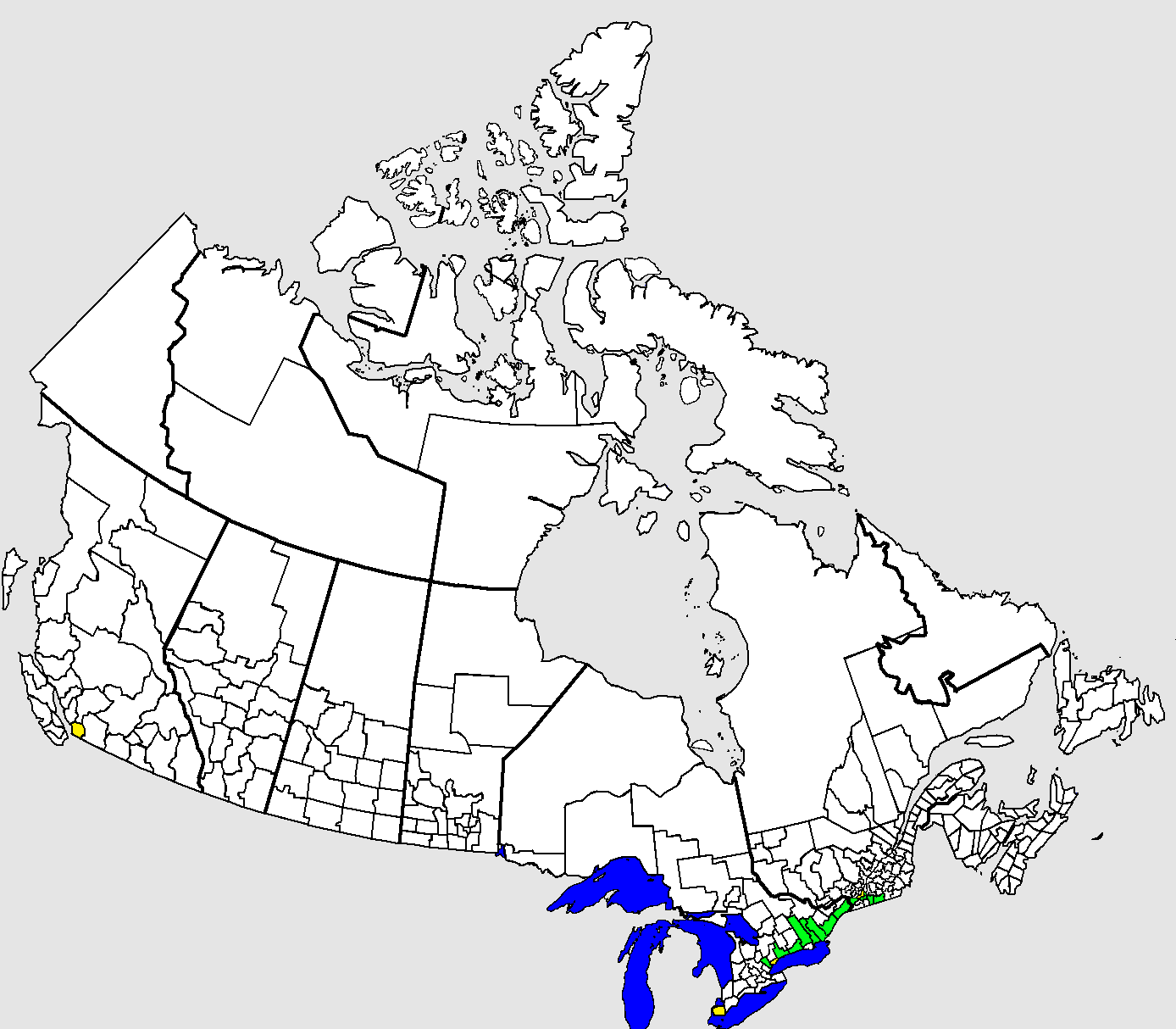
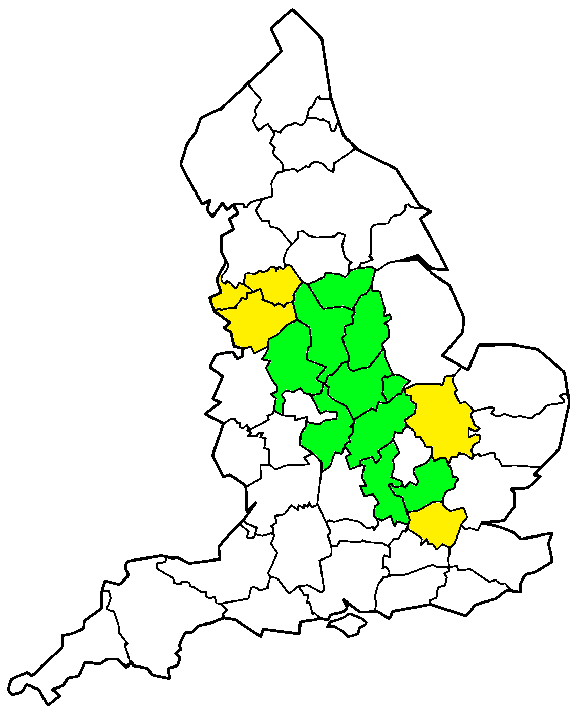
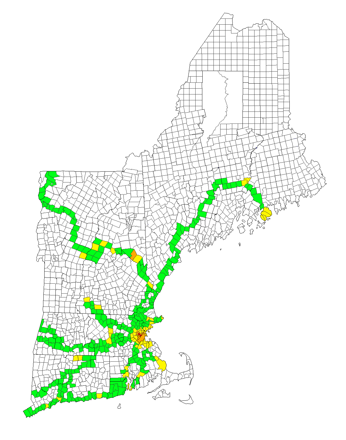
Despite the initial effort, I’ve kept my map updated ever since, and added similar maps for Canadian counties and county-equivalents and modern English counties in the United Kingdom, since I’ve been to those countries as well. I travelled a good deal around New England while I was in grad school, and since New England towns also form a complete covering of the territories of their states, I’ve also made a similar map for New England towns.
All four of these maps use the same color code: jurisdictions are colored green if I’ve passed through (driven through on a highway, taken a train through, changed planes at the airport), yellow if I’ve visited them more than just by passing through, orange if I’ve visited them more than just by passing through on seven different days, and red for the three counties I’ve lived in.
Inspired by these maps, I also—mostly as a joke—decided that I should make one of the buildings at MIT I’d been to. This map was made in August 2016 and, unlike the others, is unlikely to be regularly updated.